


Voting District 006N, Knox County, Texas
About
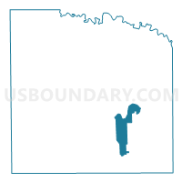
Outline

Summary
| Unique Area Identifier | 675324 |
| Name | Voting District 006N |
| County | Knox County |
| State | Texas |
| Area (square miles) | 16.52 |
| Land Area (square miles) | 16.51 |
| Water Area (square miles) | 0.02 |
| % of Land Area | 99.90 |
| % of Water Area | 0.10 |
| Latitude of the Internal Point | 33.51991340 |
| Longtitude of the Internal Point | -99.63188100 |
Maps


Graphs
Select a template below for downloading or customizing gragh for Voting District 006N, Knox County, Texas


Neighbors
Neighoring Voting District (by Name) Neighboring Voting District on the Map
- Voting District 0001, Knox County, TX
- Voting District 0004, Knox County, TX
- Voting District 0005, Knox County, TX
- Voting District 0008, Knox County, TX
- Voting District 006S, Knox County, TX
Top 10 Neighboring County Subdivision (by Population) Neighboring County Subdivision on the Map
- Munday CCD, Knox County, TX (1,614)
- Benjamin CCD, Knox County, TX (487)
- Goree CCD, Knox County, TX (255)
Top 10 Neighboring Place (by Population) Neighboring Place on the Map
Top 10 Neighboring Unified School District (by Population) Neighboring Unified School District on the Map
- Munday Consolidated Independent School District, TX (1,870)
- Benjamin Independent School District, TX (344)